Contour Guesser
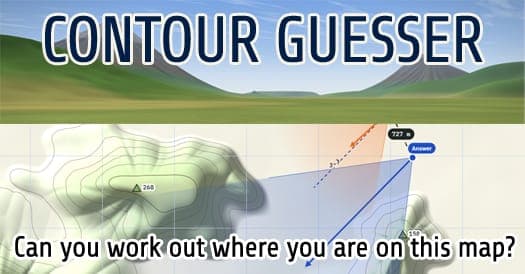
Read a contour map and pinpoint where a mountain view was taken from.
What is Contour Guesser?
Why Contour Guesser is on Unfound
It reached #32 among the past year's top posts on r/WebGames despite being posted only three days before this check, and it comes from a developer whose site lists several Steam releases.
✓ Passes the Unfound bar35 upvotes on RedditWhat's the bar?
What players say
Highlights
- Scores both where you stand and which way you face
- Peak heights, ground cover and an angle ruler to reason from
- Mouse, keyboard or touch, including pinch-to-zoom
Keep in mind
- Hard at first if you've never read contour lines
- One daily map; practice maps fill the gap
About Contour Guesser
Each round shows a rendered view of hills and peaks. You match their shapes and heights to the contour lines, where close lines mean steep slopes and each summit is labeled with its height and whether it's covered in snow, rock or grass. Then you drop your figure on the map and rotate it to match the view, using an angle ruler under the image to measure the gaps between peaks.
Read the full description
Location is worth up to 700 points and facing up to 300, and everyone gets the same map each day, with a practice mode for more. It's a smart fit for hikers, orienteers and map nerds who would rather read terrain than street signs.
Who is Contour Guesser for?
- Fans of GeoGuessr who enjoyed reading clues to guess where, or when, something is.
Contour Guesser FAQ
Is Contour Guesser free?
Yes. It's free to play in the browser.
How is Contour Guesser scored?
Up to 700 points for your location (full marks within 300 m) and up to 300 for your facing (full marks within 5 degrees).
Does Contour Guesser work on mobile?
Yes. You tap to place your person, drag to turn and pinch to zoom the map.